High-resolution satellite imagery has helped to identify most kinds of electricity infrastructure, including small-scale solar systems. Once the infrastructure has been identified, researchers can extract a range of insights, such as energy production estimates that allow for more efficient grid management, more accurate insurance assessments, and better targeting of potential customers.
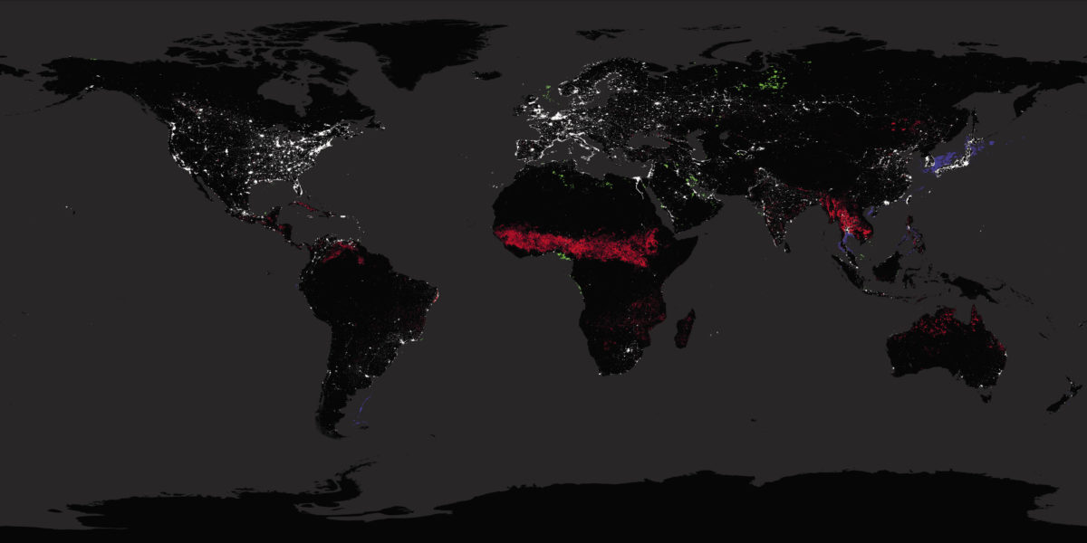
Nighttime satellite images have been used by researchers such as Christopher Elvidge at the Colorado School of Mines to assess electricity access and reliability.
Image: Christipher Elvidge
Stay informed
pv magazine is the leading trade media platform covering the global solar photovoltaics industry. Log in or purchase a digital or print version of this issue to read this article in full.
The cookie settings on this website are set to "allow cookies" to give you the best browsing experience possible. If you continue to use this website without changing your cookie settings or you click "Accept" below then you are consenting to this.