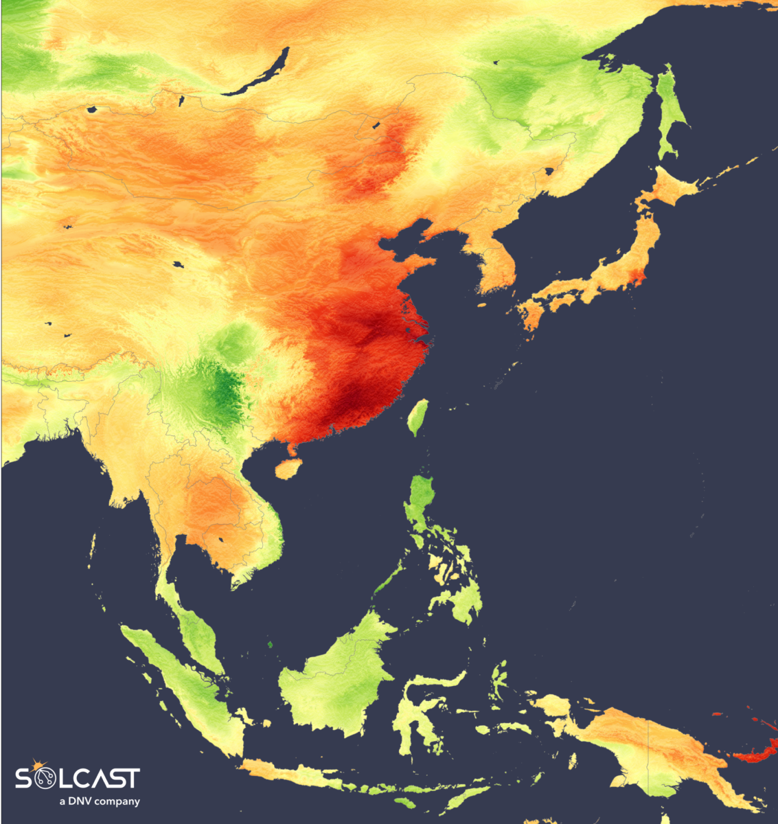
Most of eastern Asia saw a strong start to 2025 in terms of solar irradiance, with January and February delivering widespread above-average conditions. Analysis completed using the Solcast API shows increased irradiance across the Koreas, Japan, Mongolia, and mainland Southeast Asia was driven by clear, dry conditions due to a persistent Siberian high and delayed La Niña onset. In contrast, maritime Southeast Asia faced up to 20% deficits, as monsoonal rains and a fully developed La Niña brought heavy cloud cover and flooding, especially in Indonesia.
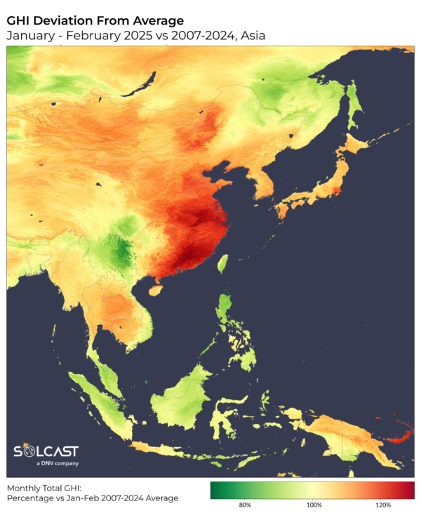
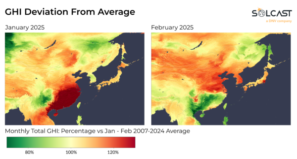
The unusually high irradiance across eastern China reached nearly 30% above average during January and February. Irradiance also rose more than 10% above average across the Korean Peninsula, Japan, Mongolia, and around the Gulf of Thailand. This pattern was driven by an expansive and persistent Siberian high, which pushed the easterly trade winds offshore, resulting in dry air masses settling over much of East Asia. The late onset of La Niña further reinforced this setup, suppressing cloud formation and allowing for consistent clear-sky conditions.
The same pressure anomaly that delivered sunny skies also brought colder-than-usual temperatures to the north. The northward displacement of cold air helped to fuel record snowfalls in Hokkaido, Japan's northernmost island. Despite these cold extremes, the broader region recorded warmth overall. According to the National Oceanic and Atmospheric Administration (NOAA), January 2025 ranked as the third warmest on record for Asia.
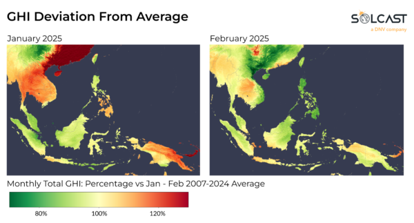
In contrast, the maritime countries of Southeast Asia struggled with irradiance deficits in January and February. Indonesia, the Philippines, and Malaysia all recorded irradiance up to 20% below average. The late-forming La Niña phase was in full effect by January, amplifying the southwest monsoon and ushering in wetter and cloudier weather across the region. Indonesia was hit particularly hard, with torrential rains in January leading to significant flooding and fatalities on the island of Java. While cloudiness is typical during January, this year’s persistent cloud cover sharply reduced surface irradiance, affecting solar performance in these typically sunny regions.
Solcast produces these figures by tracking clouds and aerosols at 1-2km resolution globally, using satellite data and proprietary AI/ML algorithms. This data is used to drive irradiance models, enabling Solcast to calculate irradiance at high resolution, with typical bias of less than 2%, and also cloud-tracking forecasts. This data is used by more than 350 companies managing over 300 GW of solar assets globally.
The views and opinions expressed in this article are the author’s own, and do not necessarily reflect those held by pv magazine.
This content is protected by copyright and may not be reused. If you want to cooperate with us and would like to reuse some of our content, please contact: editors@pv-magazine.com.


By submitting this form you agree to pv magazine using your data for the purposes of publishing your comment.
Your personal data will only be disclosed or otherwise transmitted to third parties for the purposes of spam filtering or if this is necessary for technical maintenance of the website. Any other transfer to third parties will not take place unless this is justified on the basis of applicable data protection regulations or if pv magazine is legally obliged to do so.
You may revoke this consent at any time with effect for the future, in which case your personal data will be deleted immediately. Otherwise, your data will be deleted if pv magazine has processed your request or the purpose of data storage is fulfilled.
Further information on data privacy can be found in our Data Protection Policy.