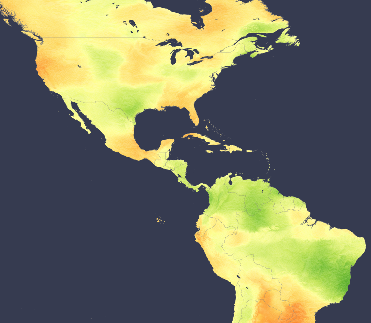
Seasonal forecasts for the upcoming winter point towards drier and sunnier conditions for key solar regions of Texas, California, the southeastern United States, Mexico and Brazil. Forecasts also agree on reduced precipitation and cloudiness across broad areas of North and South America, excluding Central America and remote parts of Canada.
The forecast is driven by borderline La Niña conditions in the tropical Pacific Ocean, whereby tropical convection favors the far western side of the ocean. The reduced convection over tropical eastern pacific waters leads to reduced cloud and storm activity downstream over the adjacent subtropical and mid-latitude continental areas of North and South America, where solar resources are located.
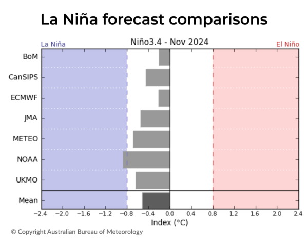
The current consensus between modeling agencies leans towards ‘neutral’ conditions, meaning neither El Niño or La Niña, but on the La Niña side of the spectrum. Most models suggest that while conditions should remain largely within the neutral range, there is a small chance of La Niña becoming stronger. US agency NOAA stands out as one of the few agencies still predicting La Niña conditions to develop during the winter. This marks a shift from earlier forecasts that had anticipated more movement away from neutral conditions.

While models differ on the strength of the borderline La Niña conditions in the Pacific Ocean forecast, they are showing fairly good agreement on the resulting cloud and precipitation impact over nearby land areas. This is especially true for the United States and Mexico, where reduced precipitation is forecast, meaning reduced cloud and favorable conditions for solar generation are likely.
However, in Central America, projections are less favorable, with above-average precipitation expected in many areas likely to impact solar production. In South America, the picture is less uniform. While key solar-generating regions of Brazil, Uruguay and Argentina are forecast to experience drier than usual conditions, other parts of South America show less consensus among meteorological models, indicating that solar producers and grid operators should expect more varied conditions across the continent.

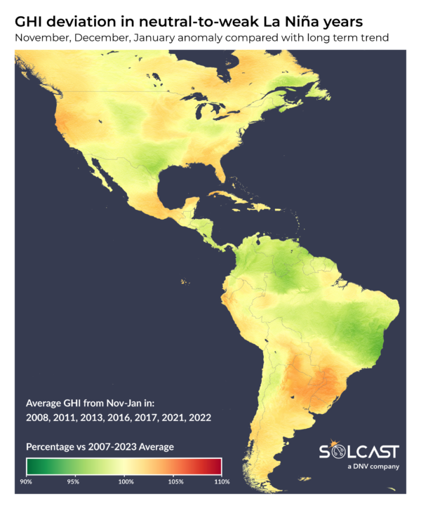
Despite a consensus between models on the likely impact of clouds and precipitation across North America, when we look back on similarly neutral-to-weak La Niña years in recent history, we see a less consistent pattern, including some areas of Texas having the opposite anomaly, experiencing more clouds and precipitation. This analysis shows the inherent uncertainty in seasonal-range forecasting and also highlights that La Niña is not the only phenomenon affecting seasonal climate conditions. For example, changes in tracks of arctic storms can also influence winter conditions over the U.S, but these changes are not predictable more than around three to four weeks ahead at most.

Solcast produces these figures by tracking clouds and aerosols at 1-2 km resolution globally, using satellite data and proprietary AI/ML algorithms. This data is used to drive irradiance models, enabling Solcast to calculate irradiance at high resolution, with typical bias of less than 2%, and also cloud-tracking forecasts. This data is used by more than 350 companies managing over 300 GW of solar assets globally.
The views and opinions expressed in this article are the author’s own, and do not necessarily reflect those held by pv magazine.
This content is protected by copyright and may not be reused. If you want to cooperate with us and would like to reuse some of our content, please contact: editors@pv-magazine.com.


By submitting this form you agree to pv magazine using your data for the purposes of publishing your comment.
Your personal data will only be disclosed or otherwise transmitted to third parties for the purposes of spam filtering or if this is necessary for technical maintenance of the website. Any other transfer to third parties will not take place unless this is justified on the basis of applicable data protection regulations or if pv magazine is legally obliged to do so.
You may revoke this consent at any time with effect for the future, in which case your personal data will be deleted immediately. Otherwise, your data will be deleted if pv magazine has processed your request or the purpose of data storage is fulfilled.
Further information on data privacy can be found in our Data Protection Policy.