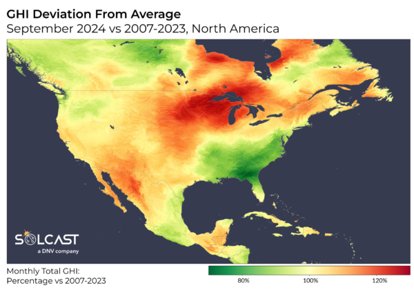
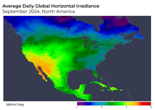
Hurricane Milton made landfall on October 9, Wednesday, bringing strong winds and heavy rainfall to much of the southeastern United States. However, its impact on solar production outside the region is expected to be minimal as the system quickly moves offshore. Outside of the southeast, much of the continental US enjoyed higher than average solar production in September, according to analysis using the Solcast API.

Hurricane Milton's relatively localized cloud has confined solar production impacts primarily to Florida and parts of the Gulf Coast. Regions such as Texas and New York, by comparison, have continued to produce solar energy at typical or above-average levels. As the system tracks eastward into the Atlantic, skies are expected to clear in its wake. This contrasts with typical systems that travel northward and spread out as they weaken. Milton's swift movement and confined influence should limit its overall effect on solar generation beyond the far southeastern states.

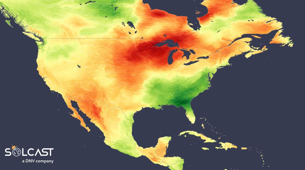
September proved particularly challenging for solar generation across the southeastern U.S., with cloudier conditions exacerbated by the influence of Hurricane Helene at the end of the month. Florida, the Gulf Coast and inland, and areas south of New York's Pacific coast saw
irradiance 15–25% below the long-term September average. This was driven by warm sea surface temperatures that fueled late-summer convective storms, culminating in Helene's significant impact. Atlanta in particular, experienced its second cloudiest September on record since 2007, a stark shift from August, which had been the sunniest since 2007.

In contrast, solar generation across much of the rest of the country remained strong, particularly in New England, the Midwest, and Southwest. These regions benefited from a combination of low pressure in the Gulf of Mexico and a southerly shift in the jet stream, which pushed warm, dry northwesterly air mass across much of the continent. Around the Great Lakes, irradiance levels were 20–30% above the September average, while areas from New England through the U.S. Southwest and into western Mexico saw irradiances approximately 10% above the norm for the month.

Solcast produces these figures by tracking clouds and aerosols at 1-2km resolution globally, using satellite data and proprietary AI/ML algorithms. This data is used to drive irradiance models, enabling Solcast to calculate irradiance at high resolution, with typical bias of less than 2%, and also cloud-tracking forecasts. This data is used by more than 300 companies managing over 150GW of solar assets globally.
The views and opinions expressed in this article are the author’s own, and do not necessarily reflect those held by pv magazine.
This content is protected by copyright and may not be reused. If you want to cooperate with us and would like to reuse some of our content, please contact: editors@pv-magazine.com.


By submitting this form you agree to pv magazine using your data for the purposes of publishing your comment.
Your personal data will only be disclosed or otherwise transmitted to third parties for the purposes of spam filtering or if this is necessary for technical maintenance of the website. Any other transfer to third parties will not take place unless this is justified on the basis of applicable data protection regulations or if pv magazine is legally obliged to do so.
You may revoke this consent at any time with effect for the future, in which case your personal data will be deleted immediately. Otherwise, your data will be deleted if pv magazine has processed your request or the purpose of data storage is fulfilled.
Further information on data privacy can be found in our Data Protection Policy.