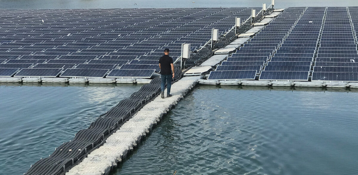
Turkish researchers have developed a novel approach to deploy floating PV (FPV) systems at the Ayvalı hydroelectric power plant (HPP) in Erzurum province, Turkey. The proposed method considers the minimum water surface area and the topography-induced shading effect on the water at various levels in a reservoir.
“This study distinguishes itself from previous research by considering horizontal and vertical variations on the dam surface, particularly considering the shading effect,” the scientists explained. “This study emphasizes the importance of utilizing suitable locations on water surfaces for FPV systems, similar to marginal lands and rooftops, through the use of remote sensing (RS) and geographic information system (GIS) techniques.”
To determine the shading effect on the reservoir, the team used RS and GIS to calculate monthly global horizontal irradiance (GHI) values on the water surface from 2017-21. Next, the team produced new digital elevation model (DEM) maps by overlapping water height changes with Advanced Land Observing Satellite (ALOS) PALSAR data. After analyzing these maps, the researchers classified pixels in regions on the surface as having annual electricity production potential that was very high, high, moderate, low, and very low.
“The results revealed that 1083.45 GWh of electricity can be produced annually by installing FPV in very high and high potential areas,” the academics said. “However, as the moderate, low, and very low regions represent only 5.02% of the reservoir surface and there is a 1.68-fold difference in production potential between the highest and lowest areas due to topography-induced shading near the coastline, it was concluded that FPV installation would not be efficient in those regions.”
The researchers said the findings underscore the importance of considering shading caused by the topography along the shore of the reservoir.
The team determined the minimum reservoir surface area for the Ayvalı dam as 504.69 hectares by using 60 Sentinel-2 satellite images, machine learning algorithms on the Google Earth Engine (GEE) platform, support vector machines (SVM), and the automatic water extraction index (AWEI). It proposed that in reservoirs where shaded areas constantly shift due to water height changes – such as dams – the shading should be taken into account and the minimum water surface area should be considered for the FPV installation.
They presented their findings in “A novel approach suggestion for assessing the impact of topographic shading on the estimation of the floating photovoltaic technical potential,” which was recently published in Energy.
“Considering the differences in electricity generation potential among regions, the installation of FPV systems should be avoided in very low and low potential areas,” the team concluded. “This study highlights the necessity of considering the shading effect on water surfaces and emphasizes the usefulness of RS and GIS techniques for this purpose.”
This content is protected by copyright and may not be reused. If you want to cooperate with us and would like to reuse some of our content, please contact: editors@pv-magazine.com.


By submitting this form you agree to pv magazine using your data for the purposes of publishing your comment.
Your personal data will only be disclosed or otherwise transmitted to third parties for the purposes of spam filtering or if this is necessary for technical maintenance of the website. Any other transfer to third parties will not take place unless this is justified on the basis of applicable data protection regulations or if pv magazine is legally obliged to do so.
You may revoke this consent at any time with effect for the future, in which case your personal data will be deleted immediately. Otherwise, your data will be deleted if pv magazine has processed your request or the purpose of data storage is fulfilled.
Further information on data privacy can be found in our Data Protection Policy.