There are no holidays for solar production. As many cultures around the world prepare for a holiday season, the Solcast team has run a long-term analysis on historical average irradiance on Christmas day, and a look ahead at the forecasts for Europe and the US, using data from the Solcast API.
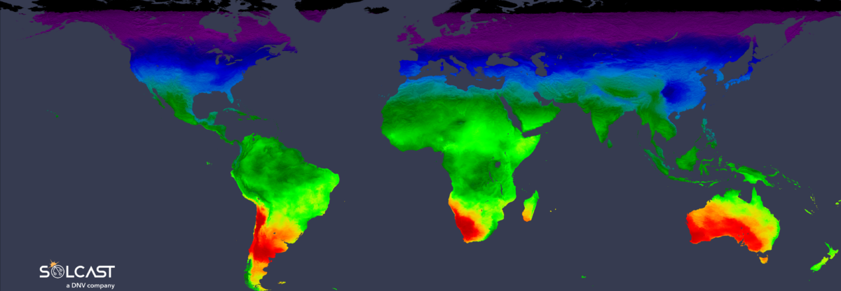
Christmas Day is just a few days after the Solstice, when the day is at its longest in the southern hemisphere and shortest in the northern hemisphere. This is the driving factor in the long-term average irradiance trends, where you can see much lower levels of total irradiance in the northern hemisphere.
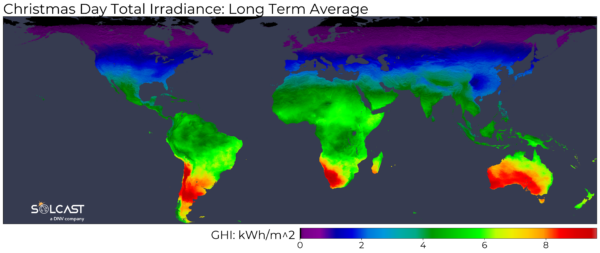
Whilst the amount of irradiance available is based on the length of the day, long-term cloud patterns are also present in the data, which you can see on the western coasts of South America, Africa and Australia. Sub-tropical latitudes in the Southern Hemisphere see more
easterly winds as the sub-tropical ridge pushes further south, keeping moisture offshore on the west coast and bringing more moisture and cloud to the east coasts.
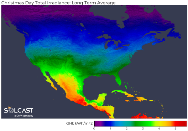
This year, much of the eastern US will receive below-average irradiance over Christmas, as an eastward-tracking low-pressure system brings rain and snow across the continent. However, the system likely won’t make it to the northeastern USA during the daytime,
leaving New England to see above-average irradiance. A high-pressure system following the rain and snow will bring sun to the Midwest and West Coast of the US, delivering average to above-average irradiance for the day.
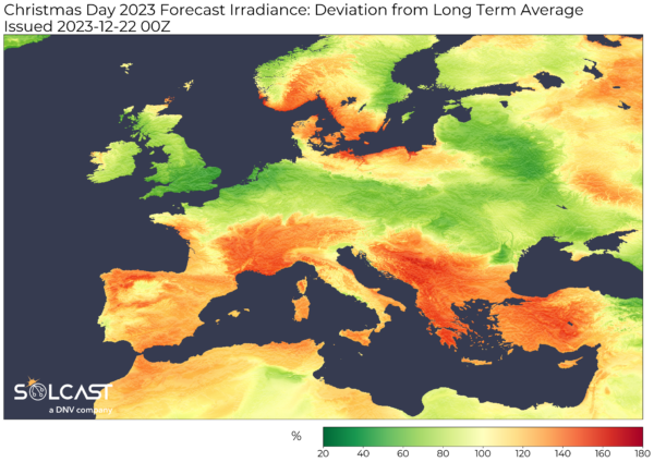
Europe will see more variation than the US compared to long-term averages. Low-pressure systems in the North Sea will push westerly winds and Atlantic moisture across the British Isles, northern France and Germany. Further south, light winds and a high-pressure system
will keep skies clearer and sunnier than usual. This will feel like a typical December day, as the Mediterranean coast has relatively less cloudy winters than further north.
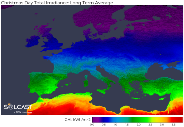
Particularly noticeable in the long-term average is the difference between Spain and Southern France, as the Pyrenees mountain range shields the Iberian peninsula from moist and cold northerly winds.
Solcast produces these figures by tracking clouds and aerosols at 1-2km resolution globally, using satellite data and proprietary AI/ML algorithms. This data is used to drive irradiance models, enabling Solcast to calculate irradiance at high resolution, with typical bias of less than 2%, and also cloud-tracking forecasts. This data is used by more than 300 companies managing over 150GW of solar assets globally.
The views and opinions expressed in this article are the author’s own, and do not necessarily reflect those held by pv magazine.
This content is protected by copyright and may not be reused. If you want to cooperate with us and would like to reuse some of our content, please contact: editors@pv-magazine.com.


By submitting this form you agree to pv magazine using your data for the purposes of publishing your comment.
Your personal data will only be disclosed or otherwise transmitted to third parties for the purposes of spam filtering or if this is necessary for technical maintenance of the website. Any other transfer to third parties will not take place unless this is justified on the basis of applicable data protection regulations or if pv magazine is legally obliged to do so.
You may revoke this consent at any time with effect for the future, in which case your personal data will be deleted immediately. Otherwise, your data will be deleted if pv magazine has processed your request or the purpose of data storage is fulfilled.
Further information on data privacy can be found in our Data Protection Policy.